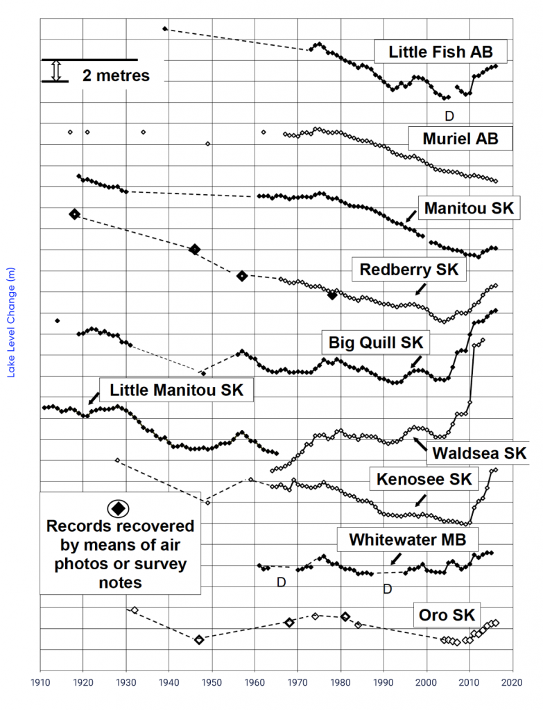
Figure-6.12: Water-level changes for 10 representative lakes across the southern Canadian prairies, 1910–2016


Relative water-level changes for 10 representative closed-basin lakes across the southern Canadian Prairies for their period of record. Dashed lines connecting separated data points are not representative of measured water levels between the points. “D” indicates that the lake was dry at the time of measurement.
van der Kamp et al. (2008); data updated through 2016.