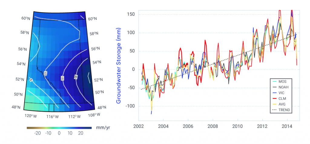
Figure-6.17: Groundwater storage trends in Alberta, 2002–2014


Average groundwater storage (GWS) trends in Alberta using the release 05 monthly GRACE gravity model for the period April 2002 to October 2014 (left). The average is determined using four land-surface models from the Global Land Data Assimilation System: Mosaic (MOS), Noah, Variable Infiltration Capacity (VIC), and Community Land Model (CLM). Time series averaged over the entire province for each model (as well as the average of all four models [AVG]), and the linear trend are provided on the right. Twelve mean monthly GWS variation maps were generated from the 139 monthly GWS variation grids to characterize the annual GWS variations.
Huang et al. (2016).